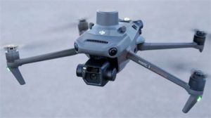
We are a Part-107 FAA small UAS licensed drone pilot. Our current fleet of drones include the DJI Mavic Enterprise with RTK GPS and a DJI Phantom 4 pro.
We have experience with multiple mapping software platforms and using either Real-Time Kinematic (RTK) corrections or Post Processing Kinematic (PPK) corrections when RTK is unavailable.
Forestry uses for drones include.
- 3-D Modeling
- Aerial Ortho-Photography
- Aerial Video
- Property Inspection for pest & trespassing